
21 49 N, 36 51 E
Paul
10:30 p.m.. (19:30 UTC) Tuesday, 1 June 2010
49 N, 36 51 E (Khor el Morob, Sudan)
There is a weather window now, and today we could have bombed 150 miles north to Sataya Reef, leaving this afternoon and arriving in about two days. The winds would have been light for the first 30 hours, and then a bit stiffer for the last 5-10. Light winds are all we want here, because they are always from the north, which is where we are going.
But we decided to stay. Sudan is, in some ways, the last of its kind on our trip. The last of the Third World, out of the way, not-so-much commercialism places we’ll be in during our circumnavigation. Sure parts of Egypt will be similar, but not quite like this. And we will be then we will be increasingly moving into modernity — Turkey, Greece, and Italy. And then home, albeit not right away. Those will all be places to see, don’t get us wrong, and they are hardly London or New York, but they do have McDonalds and such, and leaving here does feel like we’re going through another door, coming back into the Western World. So we’re melancholic about leaving, and not in a hurry to do so.
It feels like we’ve been sailing under pressure for a long while, striving to get through weather windows before they close. So we want to see these places, and not regret later rushing through the Red Sea.
But we can’t move too slowly. July will bring stifling heat here.
We went for a swim and a walk today. The snorkeling was good, and unlike some of the coral reefs that we’ve seen further south in the Red Sea, this one is still alive. Then we went for a walk around our arm of Khor el Marob.

That appears to be the nest of a very big bird atop this rock formation. Stork?
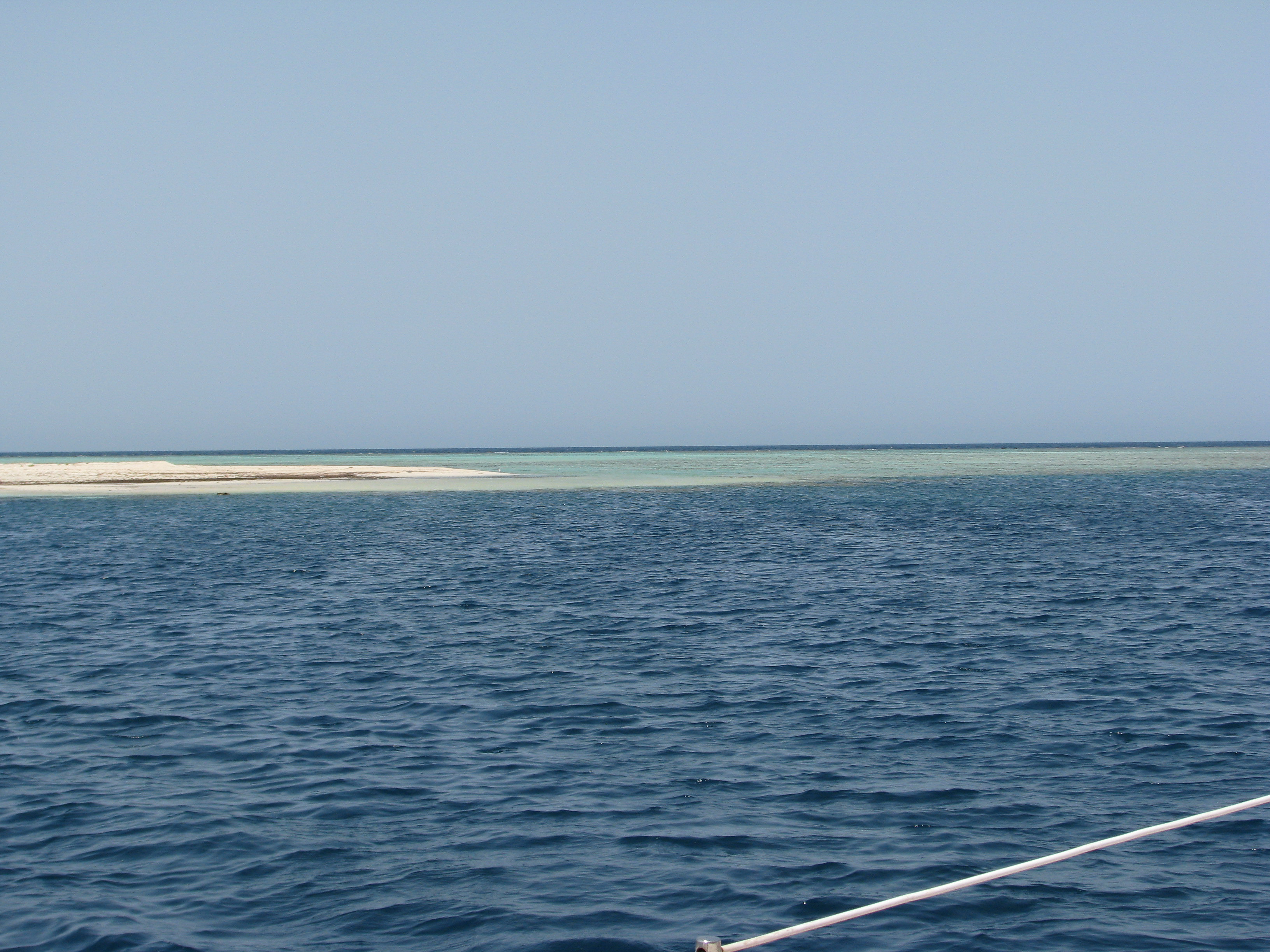
A brief pause here — What the heck is a “khor,” a “marsa,” or a “sharm?” Along the Sudanese coast, and in fact along most of the Red Sea, the desert reaches to the edge of the sea. Often, there is then a reef that extends outward, sometimes a few feet and sometimes a kilometer or two.
At intervals, one finds indentations in the land that offer varying amounts of protection from the wind and sea. A “marsa” is a “natural” bay, sometimes protected by a headland or reef jutting out into the sea. The term connotes a more open waterway. A “sharm,” on the other hand, is a narrow, deep, and typically winding indention, often pushing several kilometers inland. Both a “marsa” and a “sharm” are more correctly called a “khor” if the indentation in the land is an extension of a valley and associated estuary coming from the hills.
The definitions don’t always neatly fit, however. The charts and the guide books use the terms confusingly. Some places are called “marsas” that are really sharms or khors. Thus, our Navionics electronic chart calls this place “Marsa Mar’Ob,” our British Admiralty Chart calls it “Khor el Mar’ob,” and our pilot drops the apostrophe, calling it “Khor el Marob.”)
Whichever you choose, they are fun places to enter and anchor in, once you’ve gotten over the first-time fright of trying to squeeze into one. From the sea, the entrances are hard to make out, and often all you can see is the low desert plain leading up to the water, sometimes ending abruptly in a low wall at the water’s edge, and other times sloping down more gradually to a beach. In either case, a reef then typically slinks away from the shore, sliding under the water and out to meet your boat.
We can typically start to make out an opening about a mile away. When we get within half a mile, Sima leaves the cockpit, moves to the mast, steps into the bosun’s chair like a pair of shorts, takes the main halyard from the mast, and fastens it to the front of the chair. Loaded with a pair of binoculars, the hand-held VHF, a bottle of water, and polarized sunglasses, up the mast she goes! Paul cranks the main sheet winch until she’s up to the spreaders. The difference in height from the deck enables us to see more clearly the twists of the khors and the associated reefs. She doesn’t like the first part of it, before we enter the khor and when we’re still in the surf, as any swaying on deck is magnified considerably as you go up the mast. (“Ouch! Quit it! Ouch! Quit it!” Etc.)
For Khor el Marob, the entrance was relatively easy to pick up, and we eased in. As we entered, it narrowed, and then a branch led off to port. That branch looked narrower still.

Sima aloft as we nudge into a marsa.
The clearly-noticeable entry into the inlet.
The better anchorage was supposed to be down the main arm, which started straight ahead and then twisted and turned in the dunes to an end about three kilometers away. According to the pilot guide, we were supposed to hunt for a spot near the center of the channel where the water shallowed to 15 feet. We looked and looked, but could find nothing less than about 60 feet, unless we got uncomfortably close to the reefs on either side. We did circles and zigzags and looked some more, the two of us sharing observations, Sima aloft and Paul at the ship’s radio at the helm.
(We did pause to snap some photos of a fisherman and what looked like his sons, fishing with a net on a bank. The net set, they ran back and forth in the shallow water, trying to scare the fish into the net. As we fished around for an anchorage, they paid us no attention whatsoever.)

This fisherman and his family didn’t bat an eye when our American flagged boat did a few circles nearby looking for a spot to anchor. I can’t imagine that we would have been a common sight.
We couldn’t find a good spot. The sun was getting lower, which, because of its glare, was making it increasingly harder for Sima to pick out reefs and isolated coral heads, which can sometimes be located where you don’t like them to be.
We decided to try the narrower arm we’d seen just inside the entrance, though our Red Sea Pilot Guide gave little information about it. (The pilot guide is quite good in many ways, but would be improved if the authors more willingly noted when they did not have first-hand knowledge about a place. Instead, it sometimes uses laconic language that suggests that they do know about a place, when maybe they really don’t. As to this side alley, it suggests that “one could try Khor Tibut [our narrow arm], but the channel is narrow and the swinging room is limited.”)
Finding nothing suitable in the main channel, we proceeded down Khor Tibut, and the channel did in fact narrow, but continued to be too deep to anchor. We were traveling into the sun, so Sima was having a particularly difficult time seeing through the glare on the water. We slowed down to a crawl, nosing along at less than two knots. It was too narrow, and Paul began to turn the boat around, giving up, as the pilot guide’s sketches intimated that this was the end of the road, and that there was a shallow underwater reef immediately ahead all the way to the end of the arm, still a kilometer or so distant.
“You turning back?” Sima asked (on the radio, from aloft)?
It can be hard to see in the glare of the sun.
“I thought to do so — you can’t see, can you?” asked Paul.
“Maybe try just a little bit further,” Sima suggested. “But go slow.” So we continued on, into no-mans land, or, according to our guide, onto a reef . . . .
But the water beneath us didn’t narrow and end precipitously in a reef, as reported, but instead opened up more generously with a sand bottom, and also shallowed. It was just 25 feet deep in the middle, a good depth in which to anchor. Paul marked the spot on the chartplotter, and then began to do slow, increasingly growing circles around the spot to ensure that there was good depth if the boat swung. There was. Thank goodness.
Paul eased off the throttle, and hustled forward to let Sima down from the spreaders. She was always happy to get down.
We dropped anchor at 21 49 389 N, 036 51 996 E. This seems to be a perfect anchorage, and much better than the pilot suggested. And although not marked on any chart that we have, it appears that we’re in the armlet, Khor Tibut, and not Khor el Marob.
There’s been no one to ask.

The landscape is barren, but remarkably peaceful here.
Now, here for our second day, and with no wind, we can see far in the distance, to big mountains inland. The colors are surreal — different shades of yellows and purples and browns. The mountains in the distance give way to smaller foothills as they get closer, those giving way to rolling plains, dry and scrub-brushy, before they reach us, the colors becoming more distinct as they approach.

With the wind down, it is incredibly tranquil in here.
As we swam today, a group (herd? flock? murder?!) of camels appeared trooping slowly across a distant dune, dark-brown silhouetted against a pale sky.

Some camels wander by.
Then we saw a family that had come to picnic under a small overhang in a dune. So we approached. We met Bahshir and his wife, three kids, and mother-in-law. (Mother-in-law? Maybe. We don’t know the word for that in Arabic, so we’re not so sure.) The two women were veiled, in keeping with their Muslim religion, but also each bore three, dark blue vertical stripes tattooed on each of their cheeks, in keeping, we take it, with their African tribal traditions. (We’ve seen such facial markings before. In Suakin, some of the men similarly had three vertical stripes on each cheek, with three more going horizontally across their foreheads. Those marks are not tattooed into the skin, however, but are cut in deeply with knives when the men were boys of ten. By the looks of the scars, we could tell that the cuts were deep when made.)

Bashir and his family picnicking in the shade.
We gave Bashir’s children gifts of candy, a t-shirt, and some old address labels with American flags. (The latter had been sent to Paul’s pop by an American veteran’s group. Dad, if you get some mail from Sudan, you’ll understand. The family was not literate, however, so you should be OK.) All the gifts were a big hit. The kids started peeling the stickers off and putting them on everything in sight, including sandals, picnic dishes, and body parts.
With hand gestures and our ten words of Arabic, we told them that we sought to go to a nearby town, Fuwaken, to get some vegetables. Tomorrow, Bashir will take us.
At the end of the day, two men appeared on a nearby dune. They whistled and called toward the boat. One wore a sweat suit and the other NBA-style baggy shorts, which is, somewhat confusingly, typical dress for the military around here. We ignored them, though, because the sun was fading and because we weren’t really sure of their identity, and the distance was a bit too far to communicate meaningfully. We haven’t been using the dinghy, but instead swimming when we go to shore, and we didn’t feel like going back in the water either. Eventually, they turned and started to walk away. Then they broke into a run. Runners?! Runners can be trusted! thought Paul. He yelled to them. They stopped, turned, looked at the boat, and then turned away again, and went back to their jog. Paul watched them for five minutes until they disappeared over a dune, into the scrub brush.

Some would-be visitors to Leander.
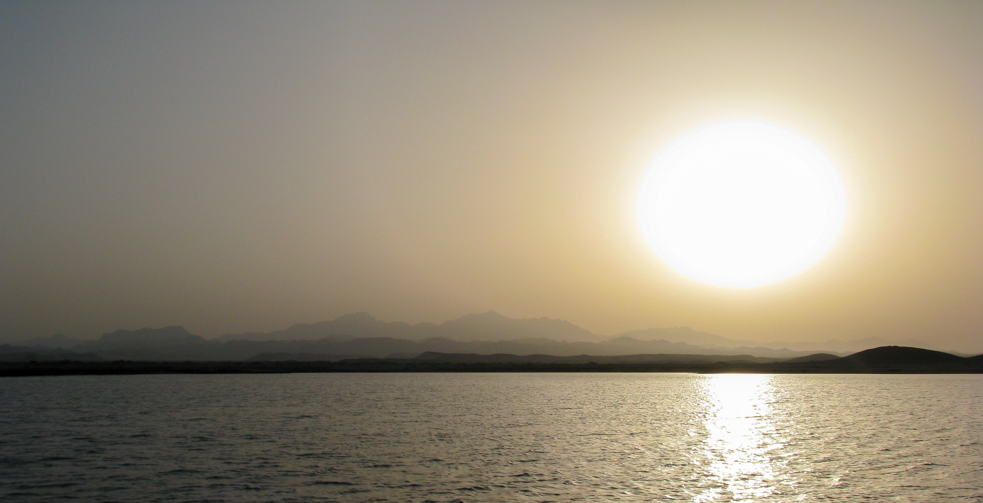
The sun sets in an incredibly undistorted fashion, going down, spectacularly, like a giant yellow ball.
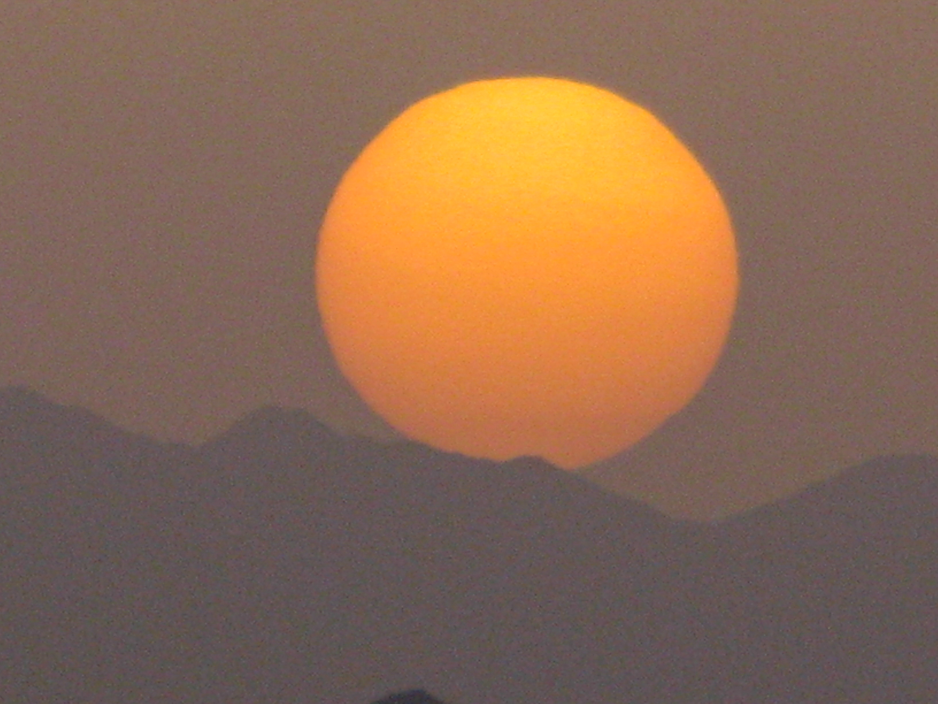
On the other hand, when the dust kicks up, the sun disappears.
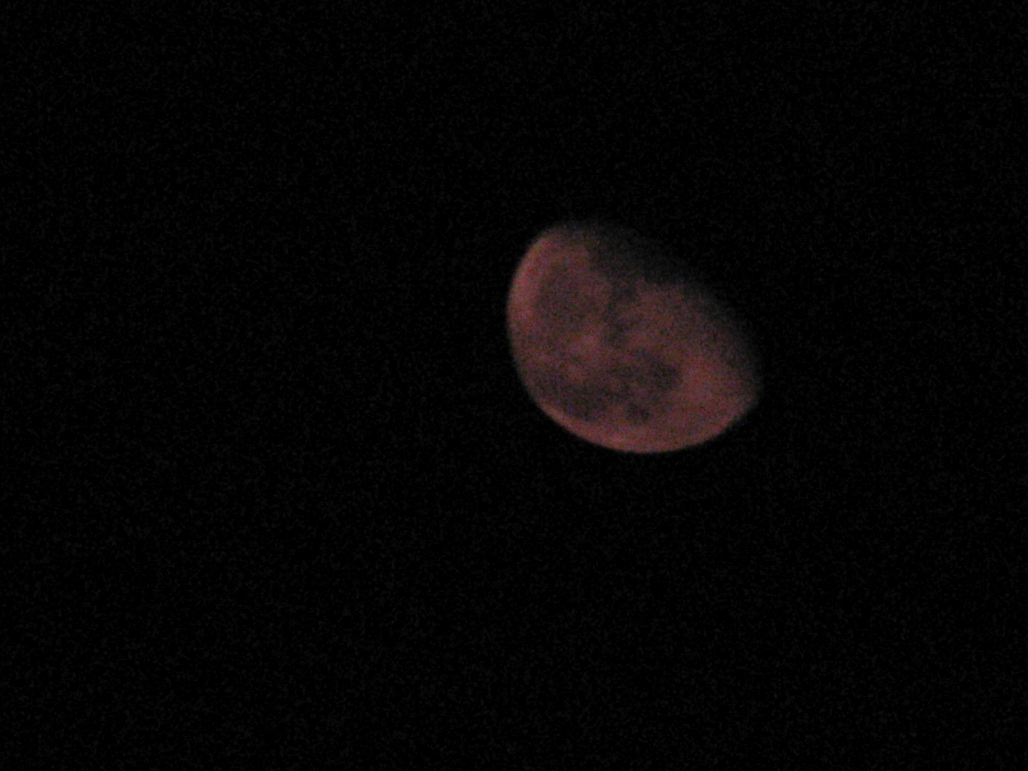
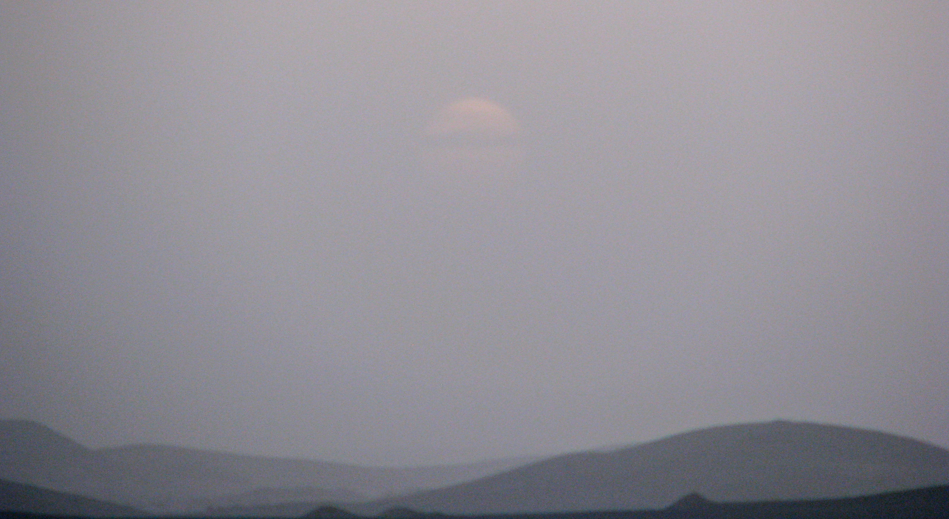
And the moon glows not white, but pink, in the dust-filled sky.
Now it is late night, and it is so quiet that the only noise that can heard are fish jumping. (Sounds romantic, but it’s actually fish-feeding time, and some are no doubt making their final splosh.) The water is still enough to make out the constellation Scorpio in the water’s reflection. Paul falls asleep on deck, watching shooting stars, and Sima on the couch, curled up comfortably.
Paul
